
Hiring Drone Surveying Services in Malaysia: Buyer Guide
Cut surveying timelines and elevate accuracy. Discover key deliverables, legal permits, and costs for drone surveying services in Malaysia.

Embarking on a commercial earthworks, infrastructure, or real estate project without reliable topographic data is a recipe for costly budget overruns. In recent years, commissioning drone surveying services malaysia has shifted from a novelty to an essential baseline for project directors, civil engineers, and quantity surveyors. Having operated survey drones across varied Malaysian terrains—from undulating jungle fringes in Ulu Langat to high-density mixed developments in Klang Valley—I have seen how aerial capture compresses survey timelines from several weeks to just a few days while improving safety.
However, procuring aerial surveying is not simply a matter of hiring someone with an off-the-shelf consumer drone. High-stakes engineering requires rigorous spatial accuracy, the right sensor payloads, and full compliance with Malaysian civil aviation and geospatial laws.
Why Malaysian Developers are Turning to Aerial Surveys
Traditional total station and GNSS rover surveys require field crews to physically traverse every breakline, crest, and ditch. On expansive greenfield sites or steep cut-and-fill slopes, this process is slow, labour-intensive, and carries safety hazards—particularly during heavy monsoon downpours where landslide risks escalate.
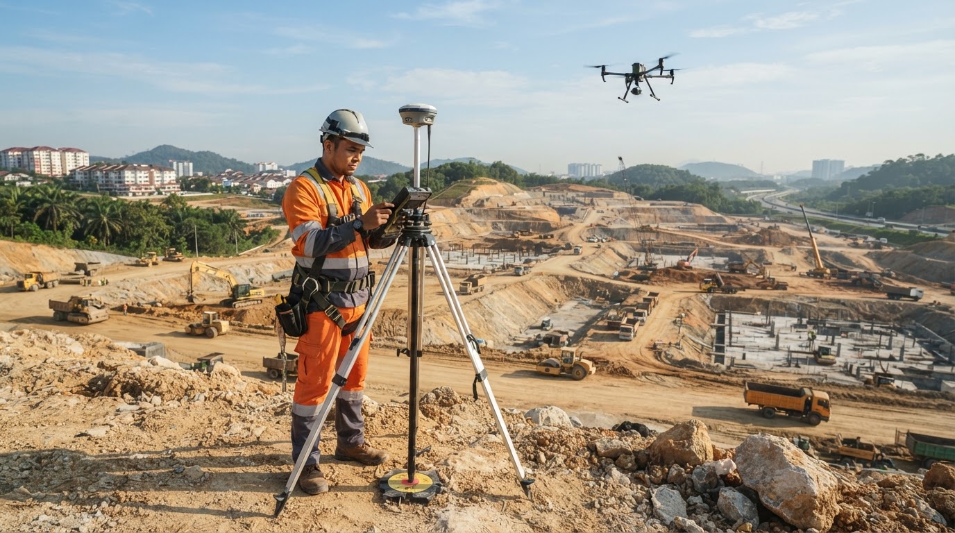
Deploying an aerial survey construction malaysia team transforms site intelligence. A multirotor or fixed-wing UAV equipped with survey-grade RTK (Real-Time Kinematic) sensors can map 100 hectares in a single afternoon. The resulting data delivers continuous surface representations rather than isolated grid points, ensuring civil engineers identify cut-and-fill discrepancies before heavy plant machinery mobilises.
Photogrammetry vs. LiDAR: Choosing the Right Sensor
One of the most critical decisions when scoping your project is selecting between high-resolution photogrammetry and aerial LiDAR. Each technology serves specific ground conditions across Malaysia's tropical landscape.
- High-Resolution Photogrammetry: Utilises overlapping high-megapixel RGB imagery to calculate 3D points. It excels on open cut-and-fill sites, active quarries, linear road expansions, and stockpile volumetric checks. Photogrammetry produces high-resolution digital orthophotos alongside 3D point clouds. Explore our network for dedicated mapping & photogrammetry operators.
- Aerial LiDAR Scanning: Employs pulsed laser beams that penetrate gaps in dense secondary jungle, oil palm canopies, and tall grass to reach the underlying ground surface. If your site features uncleared vegetation, relying on photogrammetry alone will measure the tree canopy rather than the true ground surface, leading to massive earthwork volume errors. For forested development parcels, you should explicitly commission LiDAR scanning specialists.
| Survey Parameter | Photogrammetry (RGB) | Aerial LiDAR |
|---|---|---|
| Optimal Ground Conditions | Cleared land, quarries, active worksites | Dense vegetation, thick canopy, swampy terrain |
| Primary Deliverables | High-res Orthophoto, DSM, 3D Mesh | Classified DTM, Ground Point Cloud, Contours |
| Vertical Accuracy | 2 to 5 cm (with GCPs) | 2 to 5 cm (elevation penetration) |
| Weather Sensitivity | Requires balanced daylight; sensitive to shadows | Can operate in low light or uniform overcast skies |
| Standard Drone Platform | DJI Enterprise Phantom 4 RTK / Matrice 350 RTK | Matrice 350 RTK with Zenmuse L2 / Riegl payloads |
Accuracy Benchmarks and Ground Control in Malaysia
Achieving survey-grade accuracy is not an automated feature that happens inside a flight planning app. It demands meticulous field geodesy.
For engineering-grade deliverables, vertical and horizontal Root Mean Square Error (RMSE) must remain within tight tolerances—typically under 30 mm to 50 mm. Even when flying with direct onboard RTK or post-processed kinematic (PPK) corrections, professional operators place physical Ground Control Points (GCPs) and independent Checkpoints across the site.
In Malaysia, drone surveys must tie directly into local coordinate reference systems—specifically GDM2000 (Geocentric Datum of Malaysia) and the relevant state Cassini-Soldner projections. Checkpoints measured with dual-frequency GNSS receivers tied into JUPEM's MyRTKnet base station network ensure that aerial point clouds align perfectly with your licensed land surveyor’s cadastral boundary marks.
Regulatory Approvals: CAAM and JUPEM Clearances
Never overlook regulatory compliance when hiring an aerial surveyor. Operating an unauthorised commercial flight can lead to severe fines, equipment confiscation, or site shut-downs by municipal councils and law enforcement.
- Civil Aviation Authority of Malaysia (CAAM): Commercial drone flights fall under Civil Aviation Regulations (MCAR 2016). Operators must obtain standard flight authorisation or operational approval from the Civil Aviation Authority of Malaysia, especially if operating within controlled airspace near airports or helipads.
- Jabatan Ukur dan Pemetaan Malaysia (JUPEM): Aerial photography and topographic mapping require an aerial survey permit and security clearance from JUPEM and the Chief Government Security Office (CGSO). Raw aerial data must often be vetted by authorities prior to public dissemination.
Before hiring, consult our detailed CAAM and JUPEM permits guide to understand the lead times required for official permits, which normally range from 14 to 30 working days.
Cost Factors for Drone Surveying Services in Malaysia
When budgeting for survey projects, you will find that pricing varies according to site dynamics rather than simple acreage calculations alone. Understanding the primary cost drivers helps you formulate clear project specifications:
- Terrain Complexity and Vegetation: Flat, cleared land in Shah Alam or Johor requires standard photogrammetry missions, while undulating terrain in the Titiwangsa foothills requiring LiDAR penetration incurs higher sensor mobilisation charges.
- Site Accessibility and Mobilisation: Remote access requiring 4x4 transport, multiple base station setups, or battery recharging in off-grid conditions affects project duration and daily rate cards. Review localized teams by checking available drone jobs in Selangor or other regional hubs.
- Deliverable Requirements: Raw point clouds and unedited orthomosaics require less compute time. In contrast, fully classified digital terrain models (DTM), 0.5-metre contour vectors, volume calculation reports, and CAD-ready civil packages demand dedicated spatial analysis hours.
Vetting Your Aerial Survey Partner
When reviewing bids from UAV survey service providers, make sure to look beyond equipment spec sheets. Ask candidates to produce recent accuracy verification reports demonstrating residual errors across known checkpoints. Require proof of CAAM-aligned operational risk assessments, commercial public liability insurance, and formal familiarity with JUPEM data validation routines.
Investing in accredited drone surveying services malaysia delivers verifiable geometric certainty, keeping large-scale infrastructure and land development programmes on schedule and within budget. When you are ready to kick-start your survey programme, protect your transaction through our escrow payment system and browse verified drone pilots, or simply post a drone job to receive competitive tenders from certified Malaysian operators.
Frequently Asked Questions (FAQ)
Can drone surveys replace licensed land surveyors (JTB) in Malaysia?
No. While drone surveys provide highly detailed topographical point clouds and volumetric analyses, legal cadastral boundary demarcations for land title subdivision must be certified by a Licensed Land Surveyor (Juruukur Tanah Berlesen) registered with LJT.
How accurate is a drone topography survey compared to ground surveying?
When executed with calibrated RTK/PPK drones and verified against GNSS ground checkpoints tied to MyRTKnet, vertical and horizontal accuracy typically ranges between 2 cm and 5 cm RMSE, satisfying standard civil engineering requirements.
How long does it take to secure JUPEM and CAAM drone survey permits?
Permit processing generally takes between 14 and 30 working days depending on site proximity to security installations or controlled airspace. Engaging an experienced operator who submits standard flight paperwork well in advance is essential.
Why is LiDAR preferred over photogrammetry for raw land development in Malaysia?
Photogrammetry only photographs visible surfaces, mapping the top of dense jungle or oil palm leaves rather than the ground. LiDAR emits laser pulses that slip through canopy gaps, producing accurate Digital Terrain Models (DTM) of the true earth surface.